 KWOS Jefferson City News Authority

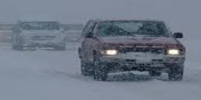
KMIZ — The Stormtrack Weather Team has issued a Weather Alert Day through noon today for increasing ice accumulation which will lead to slick roads and possible local power outages.
A storm system moving through the region will produce rain, heavy at times which will fall into surface temperatures which will be near or below freezing from Wednesday night through Thursday morning. Freezing rain and sleet will increase in intensity overnight with precipitation rates increasing and ice accumulation becoming more efficient with time. Anywhere from a glaze to three tenths of an inch of ice is possible with highest amounts expected west of HWY 63. Areas that get heavy sleet will see higher ice totals. The latest model shows about .01 inches of ice from Jefferson City between 9am and 2pm today.
